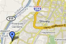
View Larger Map (Powered by |
The operating port facilities and industrial park developments are located adjacent to KY-1934, also named Cane Run Road, a four-lane primary transportation route on the west side of Louisville. This four-lane route connects with I-264 four miles to the north. I-264 offers connections with I-64, I-71, I-65 and US- 31W, all of which are national highway system routes enabling truck transportation to the north, south, east, and west. The highway systems have been very influential in developing the industrial park.
Rail service at the port and industrial park development is provided by three carriers: CSX, Norfolk Southern, and the Paducah & Louisville Railway (P & L). There is an advantage to having three rail carriers competing for business in the port area. The coal-handling facility at the port, as well as numerous tenants in the industrial park, rely on rail service to sustain their commodity movements.